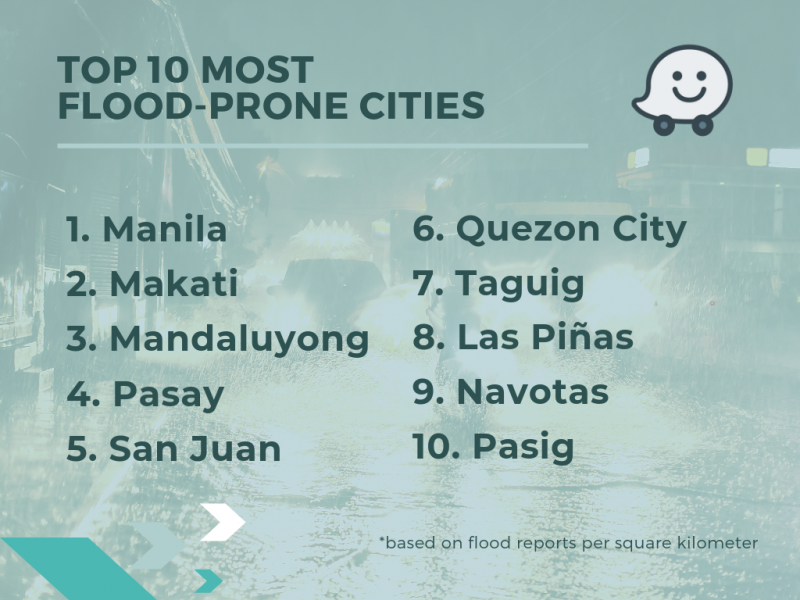
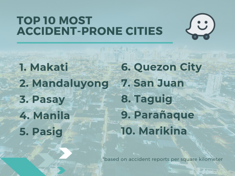
We all know Waze to be a navigation app that also has the capability to get motorists around the gridlocked streets a lot faster. But did you know that it has also taken the time to let us in on the most accident and flood prone areas in the Metro?
Yes, Waze, together with Thinking Machines, a data science consultancy group, has determined these areas based on the number of accidents and floods in a given area. It’s a way to help motorists avoid these areas and get to their destination faster and safer.
What’s even cooler is that one can get updates on such occurrences in real time. Simply follow the steps below:
- Tap ‘Reports’ (orange button on the bottom right of the screen). This will save your location if you choose to submit the report later.
- Select the report type from the ‘Report’ menu.
- Tap ‘Send’ to share the report.
With Waze, there’s no excuse to get stuck in a flood or traffic. But of course, with these being a regular thing during the rainy season, that’s another story for another day.